
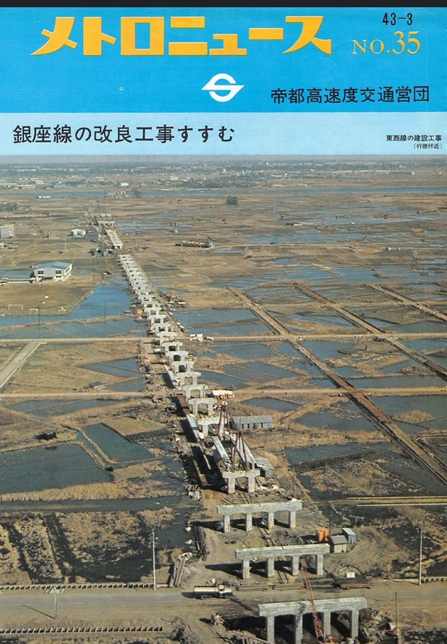
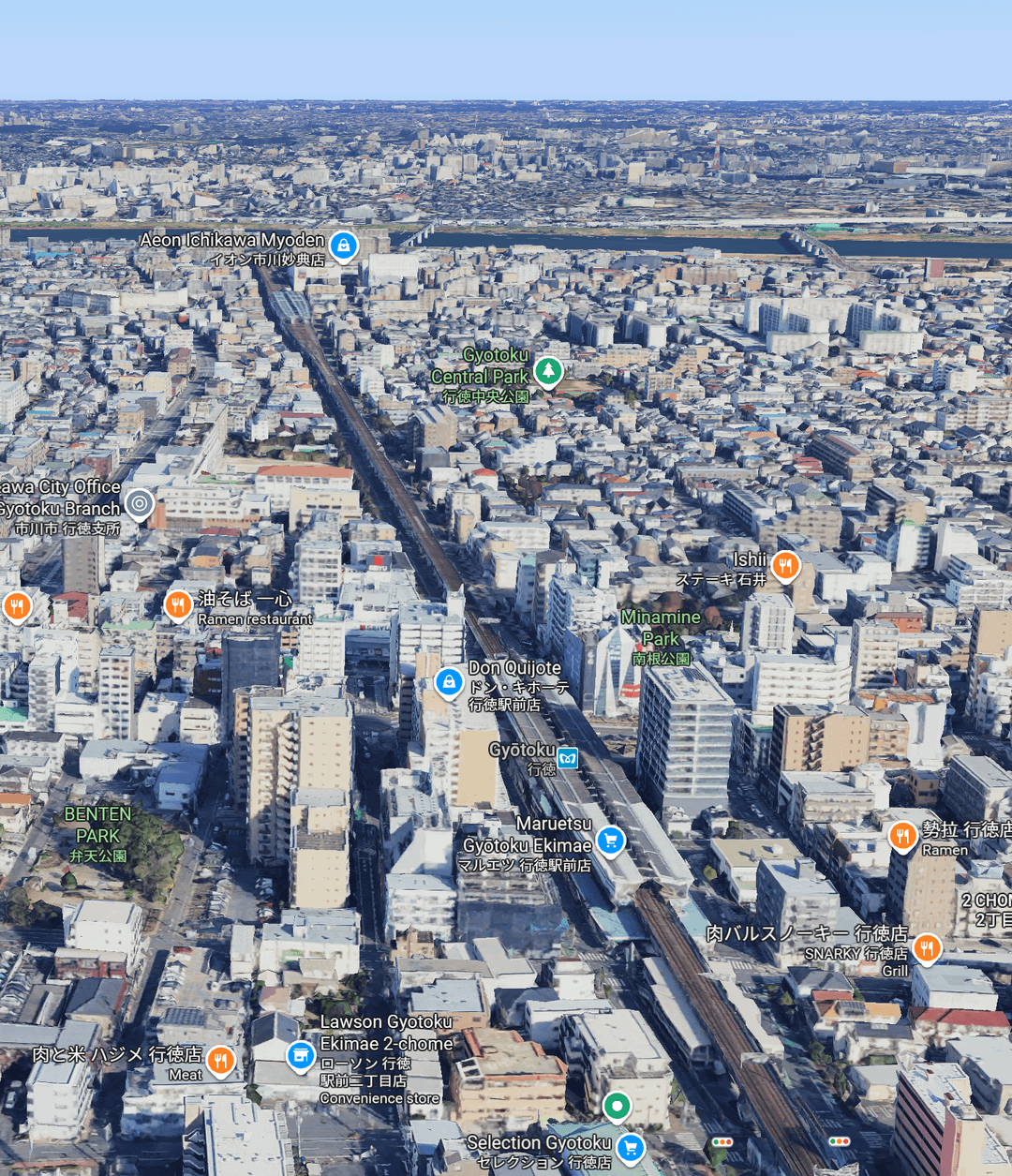
Tokyo Metro Tozai Line being built in early 1968, and what it looks like today. The station at the bottom right is Gyotoku station, just inside Chiba after having crossed from Tokyo. This section of the Metro is above ground. Edogawa river in the background.
Google Maps link: https://maps.app.goo.gl/g6AbLAL1syACtzWh9
by biwook
15 comments
Urban hellscape.
Sir, thats a screenshot from Fallout 3.
Urban sprawl is crazy
Eidan logo <3 I really hope Tokyo Metro brings it back one day…
Interesting to see so much water. Wonder how they dealt with that in order to allow for building even moderately sized buildings. Pretty cool comparison!
This is why rice is so expensive! They closed down so many rice fields! 😜
When I moved to Center Minami in 1996, the area around the subway station was pitch dark at night.
Not Tokyo, though – proudly Ichikawa!
Fascinating, what made them do that? Incredible foresight in urban planning? Or corruption and wasteful infrastructure spending that actually turned out well?
They had a long term plan
I’m surprised they immediately built it elevated, that’s some insane foresight
I lived there until 2019. Brings back the memory
When I first got married my father in law used to tell me about how his area of Meguro still had rice and vegetable fields surrounding the house.
They lived about a 5/10 minute walk from Meguro station.
Ah, the car era shaped those neighbourhoods.
One day they maybe they will change it.
いつまで帝都と呼ぶんだよw
Comments are closed.